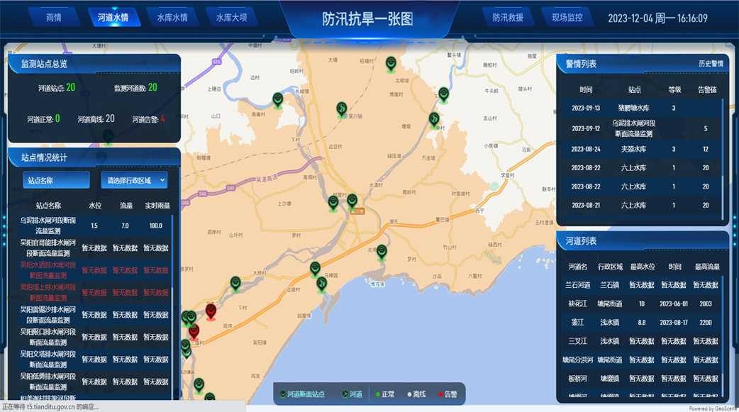
Our command and decision-making system for flood control and drought relief is based on a comprehensive, real-time updated map. This map is supplemented by ultra-high-definition video monitoring and in-depth situational awareness, allowing for comprehensive control of river and lake resource information. At the same time, relevant authorities are empowered with this system to predict the occurrence of natural disasters and respond immediately using an intelligent decision-making process. This ensures that every step of the strategy is accurate and efficient. Integrated with the mobile terminal, it provides users with decision-making capabilities at their fingertips, enabling them to make informed decisions anytime, anywhere, leading the water conservancy management towards a new height of intelligence and efficiency, and creating a new chapter of intelligent water conservancy.
Product Highlights
Efficient Information Integration and Display
By integrating a Geographic Information System (GIS), a variety of data sources, including meteorology, hydrology, topography, engineering facilities, and more, can be compiled on a single map, providing a comprehensive and intuitive platform for flood control and drought relief information.
Intelligent Prediction and Early Warning
By leveraging big data analysis and algorithmic modeling, it performs in-depth analysis of real-time data, automatically identifies high-risk areas, and sends out warning signals in advance.
Innovative Technology Application and Intelligent Assistance
The implementation of applications such as 3D GIS and real-life 3D technology enables the spatial analysis of comprehensive flood control information and the visual representation of flood control and drought emergency plans.